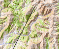
File:Absturzstelle.png
Appearance

Size of this preview: 714 × 599 pixels. Other resolutions: 286 × 240 pixels | 572 × 480 pixels | 903 × 758 pixels.
Original file (903 × 758 pixels, file size: 681 KB, MIME type: image/png)
File history
Click on a date/time to view the file as it appeared at that time.
| Date/Time | Thumbnail | Dimensions | User | Comment | |
|---|---|---|---|---|---|
| current | 20:06, 25 March 2015 |  | 903 × 758 (681 KB) | Kopiersperre | {{Information |Description={{de|Detail der Flugroute bis zur Absturzstelle von Germanwings-Flug 9525}} |Source=Flight path from http://www.flightradar24.com/data/airplanes/d-aipx/#5d42675 Background from http://opentopomap... |
| 20:05, 25 March 2015 |  | 903 × 758 (681 KB) | Kopiersperre | {{Information |Description={{de|Detail der Flugroute bis zur Absturzstelle von Germanwings-Flug 9525}} |Source=Flight path from http://www.flightradar24.com/data/airplanes/d-aipx/#5d42675 Background from http://opentopomap... |
File usage
The following page uses this file:
Global file usage
The following other wikis use this file:
- Usage on cs.wikipedia.org
- Usage on de.wikipedia.org
- Usage on en.wikinews.org
- Usage on fr.wikipedia.org
- Usage on fr.wikinews.org
- Usage on ko.wikipedia.org
- Usage on ru.wikipedia.org
- Usage on sr.wikinews.org
