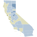
File:2016 California Proposition 66 results map by county.svg
Appearance

Size of this PNG preview of this SVG file: 600 × 600 pixels. Other resolutions: 240 × 240 pixels | 480 × 480 pixels | 768 × 768 pixels | 1,024 × 1,024 pixels | 2,048 × 2,048 pixels | 810 × 810 pixels.
Original file (SVG file, nominally 810 × 810 pixels, file size: 62 KB)
File history
Click on a date/time to view the file as it appeared at that time.
| Date/Time | Thumbnail | Dimensions | User | Comment | |
|---|---|---|---|---|---|
| current | 04:53, 31 March 2023 |  | 810 × 810 (62 KB) | CrookCoMaps61 | Standardized Shapes and Colors consistent with the other CA Prop maps |
| 06:30, 9 December 2020 |  | 167 × 284 (84 KB) | Fluffy89502 | color consistency | |
| 18:23, 7 February 2019 |  | 512 × 666 (18 KB) | Fluffy89502 | {{Information |description ={{en|1=Each shade represents a 10% difference in the vote. *Note: Trinity County was decided by a 3 vote margin.}} |date =February 7, 2019 |source =Wikimedia Commons Election Maps |author =Fluffy89502 |permission ={{PD-Self}} }} Each shade represents a 10% difference in the vote. *Note: Trinity County was decided by a 3 vote margin. |
File usage
The following page uses this file:
