Jump to content

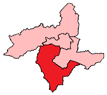
File:1918-1949 Bradford South.png

Page contents not supported in other languages.
This is a file from the Wikimedia Commons
From Wikipedia, the free encyclopedia

1918-1949_Bradford_South.png (370 × 330 pixels, file size: 6 KB, MIME type: image/png)

Summary

Description
English: 1918-1949 Bradford South
Other information
this is a simplified version of a map originally created by the UK Boundary Commission.
Date Unknown date
Source http://uselectionatlas.org/FORUM/index.php?action=profile;u=9106;sa=showPosts;start=50
Author Unknown authorUnknown author

Licensing

This work is ineligible for copyright and therefore in the public domain because it consists entirely of information that is common property and contains no original authorship.

Original upload log

The original description page was here. All following user names refer to en.wikipedia.
Date/Time Dimensions User Comment
2017-02-08 07:33 370×330× (6098 bytes) Graemp Uploading a public-domain item using [[Wikipedia:File_Upload_Wizard|File Upload Wizard]]

Captions

Add a one-line explanation of what this file represents

Items portrayed in this file

depicts

image/png

3b5cef65c2dab26a38cb2b639ef3b82480682fad

6,098 byte

330 pixel

370 pixel

File history

Click on a date/time to view the file as it appeared at that time.

Date/TimeThumbnailDimensionsUserComment
current13:11, 3 October 2018Thumbnail for version as of 13:11, 3 October 2018370 × 330 (6 KB)Junior Jumper== {{int:filedesc}} == {{Information |Description={{en|1918-1949 Bradford South<br/> ;Other information: this is a simplified version of a map originally created by the UK Boundary Commission.}} |Source={{transferred from|en.wikipedia}}<br/> (Original text : ''http://uselectionatlas.org/FORUM/index.php?action=profile;u=9106;sa=showPosts;start=50'') |Date=unknown<br/> ({{Original upload date|2017-02-08}}) |Author=unknown. {{Original uploader|Graemp|wikipedia|en}} |Permission=This image is in t...

Global file usage

The following other wikis use this file:

Metadata