
File:1870 TempleSt Boston map byFFuchs JohnWeik detail.png
Size of this preview: 800 × 377 pixels. Other resolutions: 320 × 151 pixels | 1,016 × 479 pixels.
Original file (1,016 × 479 pixels, file size: 923 KB, MIME type: image/png)
| This is a file from the Wikimedia Commons. Information from its description page there is shown below. Commons is a freely licensed media file repository. You can help. |
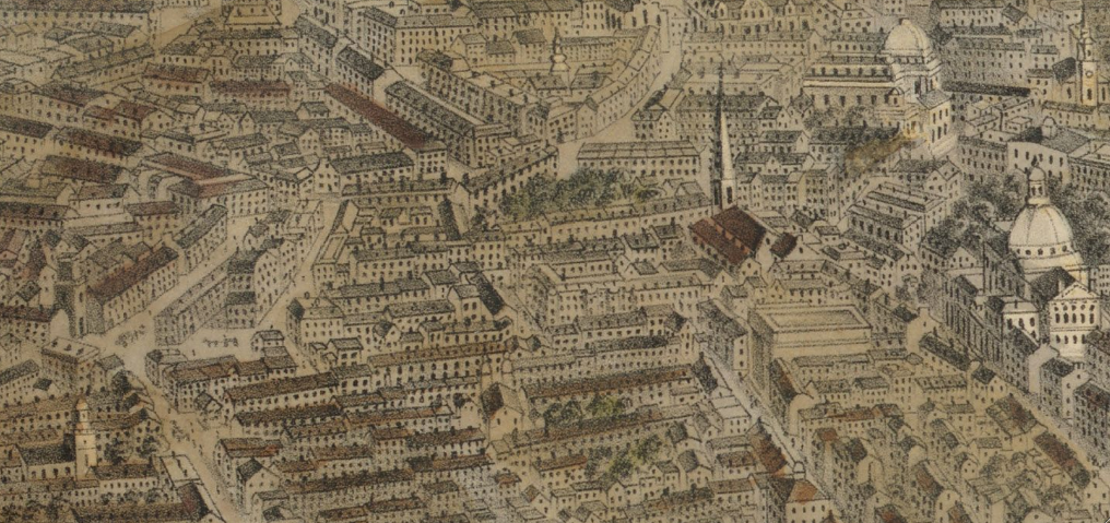
| Description | View of Temple St., Pemberton Square, Mass. State House, West Church, etc. Detail of: Map of Boston, Massachusetts, July 4, 1870. By F. Fuchs; published by John Weik. |
| Date | |
| Source | Boston Public Library. http://maps.bpl.org/details_10045 |
| Author | F. Fuchs |
|
This work is in the public domain in its country of origin and other countries and areas where the copyright term is the author's life plus 70 years or fewer. | |
| This file has been identified as being free of known restrictions under copyright law, including all related and neighboring rights. | |
File history
Click on a date/time to view the file as it appeared at that time.
| Date/Time | Thumbnail | Dimensions | User | Comment | |
|---|---|---|---|---|---|
| current | 10:18, 5 July 2010 | | 1,016 × 479 (923 KB) | M2545 | {{Information |Description=View of Temple St., Pemberton Square, Mass. State House, West Church, etc. Detail of: Map of Boston, Massachusetts, July 4, 1870. By F. Fuchs; published by John Weik. |Source=Boston Public Library. http://maps.bpl.org/details_10 |
File usage
The following pages on the English Wikipedia use this file (pages on other projects are not listed):