
File:1780 map of Charleston, South Carolina.jpeg
Size of this preview: 445 × 599 pixels. Other resolutions: 178 × 240 pixels | 356 × 480 pixels | 570 × 768 pixels | 760 × 1,024 pixels | 1,985 × 2,673 pixels.
Original file (1,985 × 2,673 pixels, file size: 1.07 MB, MIME type: image/jpeg)
| This is a file from the Wikimedia Commons. Information from its description page there is shown below. Commons is a freely licensed media file repository. You can help. |
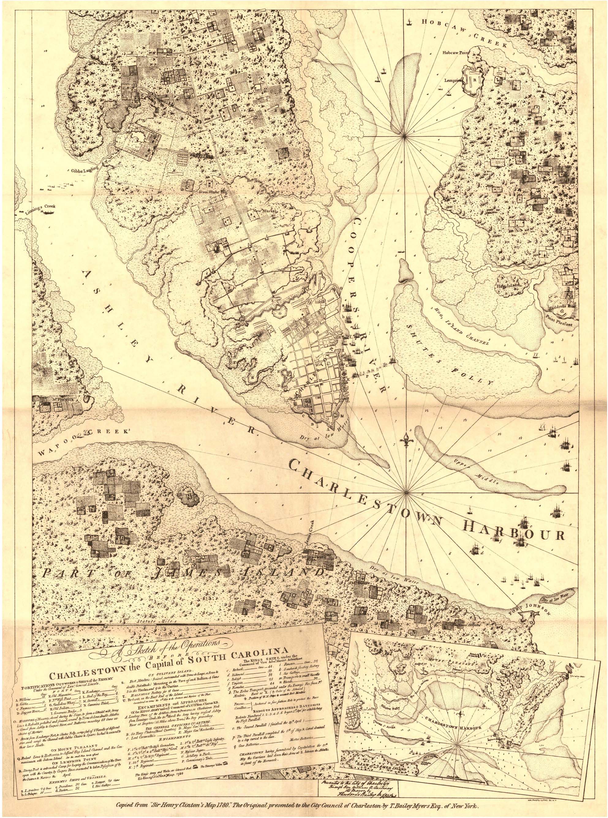
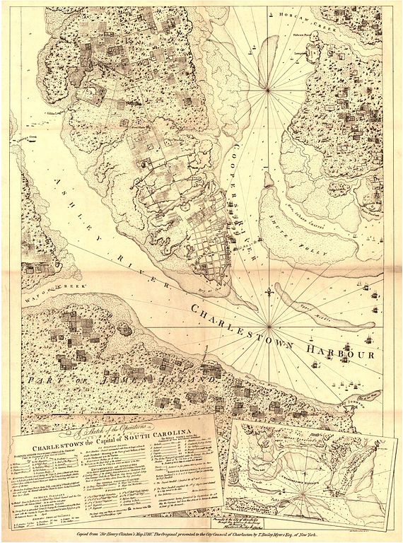
| Description | "A sketch of the operations before Charlestown, the capital of South Carolina" | ||||
| Date | |||||
| Source | Historical Maps of Alabama collection, University of Alabama Department of Geography | ||||
| Author | Sir Henry Clinton | ||||
| Permission (Reusing this file) |
|
||||
File history
Click on a date/time to view the file as it appeared at that time.
| Date/Time | Thumbnail | Dimensions | User | Comment | |
|---|---|---|---|---|---|
| current | 23:31, 17 December 2009 | | 1,985 × 2,673 (1.07 MB) | Spyder Monkey | {{Information |Description="A sketch of the operations before Charlestown, the capital of South Carolina" |Source=[http://alabamamaps.ua.edu/historicalmaps/us_states/southcarolina/index.html Historical Maps of Alabama collection], University of Alabama De |
File usage
The following pages on the English Wikipedia use this file (pages on other projects are not listed):
Global file usage
The following other wikis use this file:
- Usage on fr.wikipedia.org
- Usage on zh.wikipedia.org