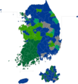
File:15대 총선 결과.png
Appearance

Size of this preview: 554 × 599 pixels. Other resolutions: 222 × 240 pixels | 444 × 480 pixels | 710 × 768 pixels | 947 × 1,024 pixels | 1,893 × 2,048 pixels | 4,351 × 4,707 pixels.
Original file (4,351 × 4,707 pixels, file size: 292 KB, MIME type: image/png)
File history
Click on a date/time to view the file as it appeared at that time.
| Date/Time | Thumbnail | Dimensions | User | Comment | |
|---|---|---|---|---|---|
| current | 09:55, 24 October 2023 |  | 4,351 × 4,707 (292 KB) | Tcfc2349 | fixed |
| 13:22, 19 October 2023 |  | 4,351 × 4,707 (292 KB) | Tcfc2349 | fixed color | |
| 07:36, 15 April 2020 |  | 4,351 × 4,707 (293 KB) | Communist 1968 | 고려님이 만든 지도로 12 몇몇 지역 경계 수정 | |
| 04:15, 15 April 2020 |  | 4,351 × 4,707 (523 KB) | Communist 1968 | Uploaded own work with UploadWizard |
File usage
The following page uses this file:
Global file usage
The following other wikis use this file:
- Usage on fr.wikipedia.org
- Usage on ko.wikipedia.org
- Usage on zh.wikipedia.org

