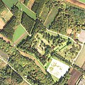
File:111014 Hekirichi jinya aerial.jpg
Appearance

Size of this preview: 600 × 599 pixels. Other resolutions: 240 × 240 pixels | 481 × 480 pixels | 905 × 904 pixels.
Original file (905 × 904 pixels, file size: 933 KB, MIME type: image/jpeg)
File history
Click on a date/time to view the file as it appeared at that time.
| Date/Time | Thumbnail | Dimensions | User | Comment | |
|---|---|---|---|---|---|
| current | 05:48, 18 December 2021 |  | 905 × 904 (933 KB) | 名古屋太郎 | {{Information |Description= 北海道北斗市戸切地陣屋跡上空の空中写真。 国土交通省撮影の空中写真CHO20116-C9A-8を使用。 |Source= 国土地理院地図・空中写真閲覧サービス |Date= 2011-10-14 |Author= 国土交通省国土地理院 |Permission= |other_versions= }} Category:History of Hokkaido Category:Taken with Vexcel UltraCam D |
File usage
The following 2 pages use this file:
Global file usage
The following other wikis use this file:


