Éragny-sur-Epte
Appearance
(Redirected from Eragny-sur-Epte)
Éragny-sur-Epte | |
|---|---|
 | |
| Coordinates: 49°18′58″N 1°46′29″E / 49.3161°N 1.7747°E | |
| Country | France |
| Region | Hauts-de-France |
| Department | Oise |
| Arrondissement | Beauvais |
| Canton | Chaumont-en-Vexin |
| Government | |
| • Mayor (2020–2026) | Bernard Michalczyk[1] |
Area 1 | 8.53 km2 (3.29 sq mi) |
| Population (2022)[2] | 599 |
| • Density | 70/km2 (180/sq mi) |
| Time zone | UTC+01:00 (CET) |
| • Summer (DST) | UTC+02:00 (CEST) |
| INSEE/Postal code | 60211 /60590 |
| Elevation | 51–124 m (167–407 ft) (avg. 71 m or 233 ft) |
| 1 French Land Register data, which excludes lakes, ponds, glaciers > 1 km2 (0.386 sq mi or 247 acres) and river estuaries. | |
Éragny-sur-Epte (French pronunciation: [eʁaɲi syʁ ɛpt], literally Éragny on Epte) is a commune in the Oise department in northern France.[3]
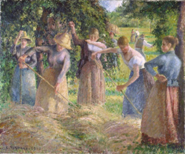
In 1884, the artist Camille Pissarro and his family moved from his home near Pontoise to Éragny on the River Epte. This was to be his principal place of residence until his death in 1903 and an ideal setting for his paintings of rural labour and the harvest.
Gallery
[edit]-
The Church at Eragny, Camille Pissarro, 1884. The Walters Art Museum.
See also
[edit]References
[edit]- ^ "Répertoire national des élus: les maires" (in French). data.gouv.fr, Plateforme ouverte des données publiques françaises. 13 September 2022.
- ^ "Populations de référence 2022" (in French). The National Institute of Statistics and Economic Studies. 19 December 2024.
- ^ INSEE commune file
Wikimedia Commons has media related to Éragny-sur-Epte.


