Vas County
Vas County
Vas vármegye | |
|---|---|
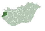
 Vas County within Hungary | |
| Country | |
| Region | Western Transdanubia |
| County seat | Szombathely |
| Districts | |
| Government | |
| • Body | Vas County Assembly |
| • President of the General Assembly | László Majthényi (Fidesz-KDNP) |
| Area | |
• Total | 3,336.14 km2 (1,288.09 sq mi) |
| • Rank | 17th in Hungary |
| Population (2018) | |
• Total | 253,305[1] |
| • Rank | 17th in Hungary |
| GDP | |
| • Total | HUF 904 billion €2.905 billion (2016) |
| Postal code | 95xx – 99xx |
| Area code(s) | (+36) 94, 95 |
| ISO 3166 code | HU-VA |
| Website | www |
Vas (Hungarian: Vas vármegye, pronounced [ˈvɒʃ]; German: Komitat Eisenburg; Slovene: Železna županija or županija Železna; Croatian: Željezna županija) is an administrative county (comitatus or vármegye) of Hungary. It was also one of the counties of the former Kingdom of Hungary. It is part of the Centrope Project.
Geography
[edit]Vas County lies in western Hungary. It shares borders with Austria (Burgenland), Slovenia (Mura Statistical Region), and the Hungarian counties of Győr-Moson-Sopron, Veszprém, and Zala. The capital of Vas County is Szombathely. Its area is 3,336 km².
History
[edit]Vas is also the name of a historic administrative county (comitatus) of the Kingdom of Hungary. Its territory is now in western Hungary, eastern Austria, and eastern Slovenia. The capital of the county was Szombathely.
Vas County arose as one of the first comitatus of the Kingdom of Hungary.
In 1920, by the Treaty of Trianon the western part of the county became part of the new Austrian land Burgenland, and a smaller part in the southwest, known as Vendvidék, became part of the newly formed Kingdom of Serbs, Croats and Slovenes (later renamed to Yugoslavia). In the Vendvidék in 1919 was founded an unrecognized state the Prekmurje Republic, similar to Burgenland the Lajtabánság. The remainder stayed in Hungary, as the present Hungarian county Vas. After World War II due to Communist reforms, a small part of the former Sopron county went to Vas County, some villages north of Zalaegerszeg went to Zala county, and a small region west of Pápa went to Veszprém county.
Since 1991, when Slovenia became independent from Yugoslavia, the Yugoslav part of the former Vas County (around Murska Sobota) is part of Slovenia.
Vas County is home to a small Slovene minority, which lives in the area between the town of Szentgotthárd and the Slovenian border (see Hungarian Slovenes).
Demographics
[edit]Religion in Vas County (2022 census – of those who declared their religion (64.0%))
In 2015, the county had a population of 253,997 and the population density was 76/km².
| Year | County population[3] | Change |
|---|---|---|
| 1949 | 283,070 | n/a |
| 1960 | -0.12% | |
| 1970 | -1.81% | |
| 1980 | 2.84% | |
| 1990 | -3.35% | |
| 2001 | -2.83% | |
| 2011 | -4.29% | |
| 2015 | -1.03% | |
| 2018 | -0.27% |
Ethnicity
[edit]Besides the Hungarian majority, the main minorities are the Croats (approx. 3,000), Roma (2,500), Germans (2,000) and Slovenes (1,500).
Total population (2011 census): 256,629
Ethnic groups (2011 census):[4]
Identified themselves: 225 052 persons:
- Hungarians: 214 512 (95.32%)
- Croats: 3 102 (1.38%)
- Gypsies: 2 559 (1.14%)
- Others and indefinable: 4 879 (2.17%)
Approx. 39,000 persons in Vas County did not declare their ethnic group at the 2011 census.
Religion
[edit]Religious adherence in the county according to 2011 census:[5]
- Catholic – 150,912 (Roman Catholic – 150,575; Greek Catholic – 276);
- Evangelical – 15,135;
- Reformed – 7,113;
- other religions – 2,087;
- Non-religious – 13,621;
- Atheism – 1,895;
- Undeclared – 65,866.
Regional structure
[edit]
| № | English and Hungarian names |
Area (km²) |
Population (2011) |
Density (pop./km²) |
Seat | № of municipalities |
| 1 | Celldömölk District Celldömölki járás |
474.13 | 24,630 | 52 | Celldömölk | 28 |
| 2 | Körmend District Körmendi járás |
614.53 | 27,177 | 44 | Körmend | 46 |
| 3 | Kőszeg District Kőszegi járás |
286.45 | 25,090 | 88 | Kőszeg | 21 |
| 4 | Sárvár District Sárvári járás |
685.46 | 38,684 | 56 | Sárvár | 42 |
| 5 | Szentgotthárd District Szentgotthárdi járás |
255.04 | 14,961 | 59 | Szentgotthárd | 16 |
| 6 | Szombathely District Szombathelyi járás |
646.36 | 112,320 | 174 | Szombathely | 40 |
| 7 | Vasvár District Vasvári járás |
374.14 | 13,767 | 37 | Vasvár | 23 |
| Vas County | 3,336.14 | 256,629 | 78 | Szombathely | 216 | |
|---|---|---|---|---|---|---|
Politics
[edit]
The Vas County Council, elected at the 2014 local government elections, is made up of 15 counselors, with the following party composition:[6]
| Party | Seats | Current County Assembly | ||||||||||
|---|---|---|---|---|---|---|---|---|---|---|---|---|
| Fidesz-KDNP | 10 | |||||||||||
| Movement for a Better Hungary (Jobbik) | 2 | |||||||||||
| Hungarian Socialist Party (MSZP) | 2 | |||||||||||
| Mayors Association for Vas County (PVME) | 1 | |||||||||||
Presidents of the General Assembly
[edit]| List of presidents since 1990[7] | |
|---|---|
| Gyula Pusztai (MSZP) | 1990–1998 |
| Péter Markó (Fidesz) | 1998–2006 |
| Ferenc Kovács (Fidesz-KDNP) | 2006–2014 |
| László Majthényi (Fidesz-KDNP) | 2014– |
Municipalities
[edit]Vas County has 1 urban county, 12 towns and 203 villages.
- City with county rights
(ordered by population, as of 2011 census)
- Szombathely (78,884) – county seat
- Towns
- Sárvár (14,777)
- Körmend (11,950)
- Kőszeg (11,666)
- Celldömölk (11,113)
- Szentgotthárd (8,678)
- Vasvár (4,387)
- Vép (3,534)
- Bük (3,301)
- Csepreg (3,286)
- Répcelak (2,575)
- Jánosháza (2,529)
- Őriszentpéter (1,178)
- Villages
- Acsád
- Alsószölnök
- Alsóújlak
- Andrásfa
- Apátistvánfalva
- Bajánsenye
- Balogunyom
- Bejcgyertyános
- Bérbaltavár
- Boba
- Borgáta
- Bozsok
- Bozzai
- Bögöt
- Bögöte
- Bő
- Bucsu
- Cák
- Chernelházadamonya
- Csákánydoroszló
- Csánig
- Csehi
- Csehimindszent
- Csempeszkopács
- Csénye
- Csipkerek
- Csönge
- Csörötnek
- Daraboshegy
- Dozmat
- Döbörhegy
- Döröske
- Duka
- Egervölgy
- Egyházashetye
- Egyházashollós
- Egyházasrádóc
- Felsőcsatár
- Felsőjánosfa
- Felsőmarác
- Felsőszölnök
- Gasztony
- Gencsapáti
- Gersekarát
- Gérce
- Gór
- Gyanógeregye
- Gyöngyösfalu
- Győrvár
- Halastó
- Halogy
- Harasztifalu
- Hegyfalu
- Hegyháthodász
- Hegyhátsál
- Hegyhátszentjakab
- Hegyhátszentmárton
- Hegyhátszentpéter
- Horvátlövő
- Horvátzsidány
- Hosszúpereszteg
- Ikervár
- Iklanberény
- Ispánk
- Ivánc
- Ják
- Jákfa
- Karakó
- Katafa
- Káld
- Kám
- Keléd
- Kemeneskápolna
- Kemenesmagasi
- Kemenesmihályfa
- Kemenespálfa
- Kemenessömjén
- Kemenesszentmárton
- Kemestaródfa
- Kenéz
- Kenyeri
- Kercaszomor
- Kerkáskápolna
- Kétvölgy
- Kisrákos
- Kissomlyó
- Kisunyom
- Kiszsidány
- Kondorfa
- Köcsk
- Kőszegdoroszló
- Kőszegpaty
- Kőszegszerdahely
- Lócs
- Lukácsháza
- Magyarlak
- Magyarmádalja
- Magyarszecsőd
- Magyarszombatfa
- Meggyeskovácsi
- Megyehíd
- Mersevát
- Mesterháza
- Mesteri
- Meszlen
- Mikosszéplak
- Molnaszecsőd
- Nagygeresd
- Nagykölked
- Nagymizdó
- Nagyrákos
- Nagysimonyi
- Nagytilaj
- Nádasd
- Nárai
- Narda
- Nemesbőd
- Nemescsó
- Nemeskeresztúr
- Nemeskocs
- Nemeskolta
- Nemesládony
- Nemesmedves
- Nemesrempehollós
- Nick
- Nyőgér
- Olaszfa
- Ostffyasszonyfa
- Oszkó
- Orfalu
- Ólmod
- Ölbő
- Őrimagyarósd
- Pankasz
- Pácsony
- Pápoc
- Pecöl
- Perenye
- Peresznye
- Petőmihályfa
- Pinkamindszent
- Pornóapáti
- Porpác
- Pósfa
- Pusztacsó
- Püspökmolnári
- Rábagyarmat
- Rábahídvég
- Rábapaty
- Rábatöttös
- Rádóckölked
- Rátót
- Répceszentgyörgy
- Rönök
- Rum
- Sajtoskál
- Salköveskút
- Sárfimizdó
- Sé
- Simaság
- Sitke
- Söpte
- Sorkifalud
- Sorkikápolna
- Sorokpolány
- Sótony
- Szaknyér
- Szakonyfalu
- Szalafő
- Szarvaskend
- Szatta
- Szeleste
- Szemenye
- Szentpéterfa
- Szergény
- Szőce
- Tanakajd
- Táplánszentkereszt
- Telekes
- Tokorcs
- Tompaládony
- Tormásliget
- Torony
- Tömörd
- Uraiújfalu
- Vasalja
- Vasasszonyfa
- Vasegerszeg
- Vashosszúfalu
- Vaskeresztes
- Vassurány
- Vasszécseny
- Vasszentmihály
- Vasszilvágy
- Vámoscsalád
- Vásárosmiske
- Vát
- Velem
- Velemér
- Viszák
- Vönöck
- Zsennye
- Zsédeny
Gallery
[edit]-
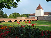
Szombathely, the capital of the county
-
Jurisics Square in Kőszeg
-
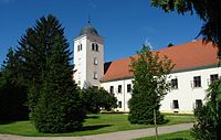
Saint George's Abbey and the Saint James Chapel in Ják
-
Nádasdy Castle, Sárvár
-
Batthyány Mansion in Körmend
-
Batthyány Mansion in Csákánydoroszló
-
Traditional Hungarian house in Szalafő
References
[edit]- ^ nepesseg.com, population data of Hungarian settlements
- ^ Regions and Cities > Regional Statistics > Regional Economy > Regional GDP per Capita, OECD.Stats. Accessed on 16 November 2018.
- ^ népesség.com, "Vas megye népessége 1870-2015"
- ^ 1.1.6. A népesség anyanyelv, nemzetiség és nemek szerint – Frissítve: 2013.04.17.; Hungarian Central Statistical Office (in Hungarian)
- ^ 2011. ÉVI NÉPSZÁMLÁLÁS, 3. Területi adatok, 3.18 Vas megye, (in Hungarian) [1]
- ^ A Vas Megyei Közgyűlés tagjai, (in Hungarian) [2]
- ^ Önkormányzati választások eredményei (in Hungarian)
External links
[edit]- Official site in Hungarian and English
- Vas Népe (vaol.hu) - The county portal
- Hungary at GeoHive


