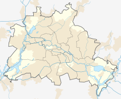
Eichborndamm station
Appearance
(Redirected from Eichborndamm railway station)
| Hp | |||||||||||
 Hallway under the platform | |||||||||||
| General information | |||||||||||
| Location | Reinickendorf, Reinickendorf borough, Berlin Germany | ||||||||||
| Owned by | DB Netz | ||||||||||
| Operated by | DB Station&Service | ||||||||||
| Line(s) | Kremmen Railway ( | ||||||||||
| Platforms | 1 side platform | ||||||||||
| Tracks | 1 | ||||||||||
| Train operators | S-Bahn Berlin | ||||||||||
| Connections | |||||||||||
| Construction | |||||||||||
| Accessible | Yes | ||||||||||
| Other information | |||||||||||
| Station code | 7722 | ||||||||||
| DS100 code | BEBD[1] | ||||||||||
| IBNR | 8089101 | ||||||||||
| Category | 5[2] | ||||||||||
| Fare zone | VBB: Berlin B/5656[3] | ||||||||||
| Website | www.bahnhof.de | ||||||||||
| History | |||||||||||
| Opened | 1 October 1894 28 May 1995 | ||||||||||
| Closed | 9 January 1984 | ||||||||||
| Electrified | 16 March 1927 | ||||||||||
| Previous names | 1894-1994 Eichbornstraße | ||||||||||
| Key dates | |||||||||||
| 1945, late April - 10 June | operation interrupted | ||||||||||
| Services | |||||||||||
| |||||||||||
 | |||||||||||
Eichborndamm is a railway station in the Reinickendorf neighbourhood of the homonymous borough in Berlin. It is served by the S-Bahn line S25.
The station was called Eichbornstraße until 29 May 1994.
References
[edit]- ^ Eisenbahnatlas Deutschland (German railway atlas) (2017 ed.). Schweers + Wall. 2017. ISBN 978-3-89494-146-8.
- ^ "Stationspreisliste 2025" [Station price list 2025] (PDF) (in German). DB Station&Service. 28 November 2024. Retrieved 5 December 2024.
- ^ "Der VBB-Tarif: Aufteilung des Verbundgebietes in Tarifwaben und Tarifbereiche" (PDF). Verkehrsbetrieb Potsdam. Verkehrsverbund Berlin-Brandenburg. 1 January 2017. Archived from the original (PDF) on 27 October 2020. Retrieved 25 November 2019.
- Schwandl, R (2003). "Berlin S-Bahn Album".
52°34′39″N 13°19′01″E / 52.5776°N 13.3169°E


