Kutigi
Appearance
(Redirected from Draft:Kutigi)
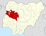
Kutigi is a town in central Nigeria, border to Bida, Mokwa and north of the Niger River. The countryside is generally flat with rolling hills, with grassland and trees.[1]
It is the headquarters of Lavun Local Government Area in Niger State, Nigeria.[2][3]
This is a place situated in Lavun, with geographical coordinates of 9° 12' 0" North, 5° 36' 0" East and its original name (with diacritics) is Kutigi. it is a Nupe, speaking area.[4]
Notable People
[edit]- Adamu Baba-Kutigi (born 1956) - physicist
References
[edit]- ^ "Kutigi: Nigeria". Retrieved 19 May 2019.
- ^ Orekoya, Tayo (2001). Local government administration in Nigeria. Vol. 2. Pure Language Communications. ISBN 9789783544901.
- ^ =9°27′N 5°38′E / 9.450°N 5.633°E.
- ^ Area place kutigi " Kutigi Lavun Nigeria", Maplandia source. 27 June 2019.

