
Dansville, Michigan: Difference between revisions
No edit summary |
|||
| Line 111: | Line 111: | ||
==Point of interest== |
==Point of interest== |
||
Visible throughout the village is the [http://www.waymarking.com/waymarks/WM8MX Octagon House]. This drew extensive media attention as a base for state aid during droughts of 1986. Military personnel rationed and supplied additional water supplies when required during the summer months, with these images often entering state news broadcasts at the time. |
Visible throughout the village is the [http://www.waymarking.com/waymarks/WM8MX Octagon House]. This drew extensive media attention as a base for state aid during droughts of 1986. Military personnel rationed and supplied additional water supplies when required during the summer months, with these images often entering state news broadcasts at the time. |
||
Home of Elijah. Who is awesome. |
|||
==References== |
==References== |
||
Revision as of 21:42, 15 December 2011
Dansville, Michigan | |
|---|---|
 | |
| Country | United States |
| State | Michigan |
| County | Ingham |
| Area | |
| • Total | 1.0 sq mi (2.6 km2) |
| • Land | 1.0 sq mi (2.6 km2) |
| • Water | 0.0 sq mi (0.0 km2) |
| Elevation | 961 ft (293 m) |
| Population (2010) | |
| • Total | 563 |
| • Density | 563.0/sq mi (217.4/km2) |
| Time zone | UTC-5 (Eastern (EST)) |
| • Summer (DST) | UTC-4 (EDT) |
| ZIP code | 48819 |
| Area code | 517 |
| FIPS code | 26-19780Template:GR |
| GNIS feature ID | 0624307Template:GR |
Dansville is a village in Ingham Township, Ingham County in the U.S. state of Michigan. It lies 22 miles (35 km) southeast of downtown Lansing, Michigan's capital city. The population was 563 at the 2010 census.
Description
Dansville is a small village, with much of its economy based on agriculture. While the village is in close proximity to the state capital and Michigan State University, it has seen little commercial development over its history. The small town's economy is supported primarily by small business, agriculture research and production.
Education
Dansville Schools offer a positive learning environment for students to learn and thrive with strong academic offerings including AP classes, art education, a K-12 Spanish program, physical education, vocal and instrumental music, technology, athletics, and a broad array of extracurricular activities. Furthermore, the community is strongly family-centered and enjoys a high level of involvement and support from parents and citizens.[1]
History
The area that is now the village of Dansville was originally settled by Samuel Crossman in 1844, who like many settlers at the time, had come from the state of New York in search of a new life. Samuel Crossman's son, Daniel Crossman, officially platted the village in 1857, naming it after himself and the village's first postmaster, Dr. Daniel T. Weston. The settlement wasn't actually incorporated as a village until 1867.
Geography
According to the United States Census Bureau, the village has a total area of 1.0 square mile (2.6 km2), all land.
Demographics
| Census | Pop. | Note | %± |
|---|---|---|---|
| 1990 | 437 | — | |
| 2000 | 429 | −1.8% | |
| 2010 | 563 | 31.2% |
As of the censusTemplate:GR of 2000, there were 429 people, 142 households, and 111 families residing in the village. The population density was 429.0 per square mile (165.6/km²). There were 148 housing units at an average density of 148.0 per square mile (57.1/km²). The racial makeup of the village was 95.80% White, 0.23% African American, 0.93% Native American, 0.70% Asian, 1.63% from other races, and 0.70% from two or more races. Hispanic or Latino of any race were 3.26% of the population.
There were 142 households out of which 47.9% had children under the age of 18 living with them, 61.3% were married couples living together, 12.7% had a female householder with no husband present, and 21.8% were non-families. 17.6% of all households were made up of individuals and 4.9% had someone living alone who was 65 years of age or older. The average household size was 2.98 and the average family size was 3.40.
In the village the population was spread out with 30.8% under the age of 18, 8.6% from 18 to 24, 35.7% from 25 to 44, 18.9% from 45 to 64, and 6.1% who were 65 years of age or older. The median age was 32 years. For every 100 females there were 91.5 males. For every 100 females age 18 and over, there were 94.1 males.
The median income for a household in the village was $48,214, and the median income for a family was $51,964. Males had a median income of $36,528 versus $25,500 for females. The per capita income for the village was $16,951. About 4.3% of families and 4.3% of the population were below the poverty line, including 5.0% of those under age 18 and 17.9% of those age 65 or over.
Point of interest
Visible throughout the village is the Octagon House. This drew extensive media attention as a base for state aid during droughts of 1986. Military personnel rationed and supplied additional water supplies when required during the summer months, with these images often entering state news broadcasts at the time. Home of Elijah. Who is awesome.
References
External links
Municipalities and communities of Ingham County, Michigan, United States | ||
|---|---|---|
| Cities | 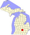 | |
| Villages | ||
| Charter townships | ||
| Civil townships | ||
| CDPs | ||
| Other communities | ||
| Footnotes | ‡This populated place also has portions in an adjacent county or counties | |