Dandagaun, Dhankuta
Appearance
(Redirected from Dandagaun, Kosi)
Dandagaun
डाँडागाउँ | |
|---|---|
| Nickname(s): Hamro Gaun, Ramro Gaun | |
 | |
| Country | |
| Province | Province No. 1 |
| Municipality | Mahalaxmi Municipality 3 |
| District | Dhankuta District |
| Government | |
| Area | |
• Total | 14.5 km2 (5.6 sq mi) |
| Population (2017) | |
• Total | 2,500+ ( estimated ) |
| Time zone | UTC+5:45 (Nepal Time) |
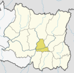
Dandagaun is a small village located northern part of Mahalaxmi Municipality at Dhankuta district in the Province no. 1 of eastern Nepal. At the time of the 1991 Nepal census it had a population of 1838 people living in 924 individual households. But latest survey which hold by village it has more than 2500 population.[1]
References
[edit]- ^ "Nepal Census 2001". Nepal's Village Development Committees. Digital Himalaya. Archived from the original on 12 October 2008. Retrieved 24 November 2008.
27°10′N 87°21′E / 27.167°N 87.350°E

