Jones-Confluence Point State Park
| Confluence Point State Park | |
|---|---|
 Confluence Point with the Mississippi on the left and the Missouri on the right | |
| Location | West Alton, Missouri, United States |
| Coordinates | 38°49′3″N 90°7′11″W / 38.81750°N 90.11972°W |
| Area | 1,121.43 acres (453.83 ha)[1] |
| Established | 2001[2] |
| Administered by | Missouri Department of Natural Resources |
| Visitors | 48,796 (in 2023)[1] |
| Website | Official website |
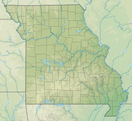
Edward "Ted" and Pat Jones-Confluence Point State Park is a public recreation area located on the north side of the Missouri River at its confluence with the Mississippi River in St. Charles County, Missouri.[3] The state park encompasses 1,121 acres (454 ha) of shoreline and bottomland and is managed by the Missouri Department of Natural Resources, which "plans to restore a natural floodplain reminiscent of what Lewis and Clark might have seen along the lower Missouri River."[4] The park is part of the Mississippi Greenway (formerly known as the Confluence Greenway)[5] and sits opposite the Columbia Bottom Conservation Area on the south bank of the Missouri River.
History
[edit]
The Lewis and Clark Expedition began at the confluence in 1804, and the explorers returned there at the end of their journey.[4] Following the purchase of the site through the aid of a grant from the Danforth Foundation, the Western Rivers Conservancy conveyed the land to the Missouri Department of Natural Resources and the Metropolitan Parks and Recreation District in 2001.[6] The park opened May 9, 2004. It is named for Edward Jones Investments heir Edward D. "Ted" Jones and his wife Pat Jones, who donated $2.2 million for development of the Katy Trail.[4]
Activities and amenities
[edit]The area offers short trails, interpretive kiosks, and birdwatching.[4]
References
[edit]- ^ a b "Data Sheet: Confluence Point State Park" (PDF). Missouri Department of Natural Resources. November 2017. Retrieved December 30, 2024.
- ^ "State Park Land Acquisition Summary". Missouri State Parks. Retrieved August 17, 2015.
- ^ "Confluence Point State Park". Missouri Department of Natural Resources. Retrieved September 29, 2014.
- ^ a b c d "Confluence Point State Park: General Information". Missouri Department of Natural Resources. Retrieved September 29, 2014.
- ^ "Mississippi Greenway Master Plan". Great Rivers Greenway. Retrieved December 30, 2024.
- ^ "Riverlands" (PDF). Western Rivers Conservancy. Fall 2002. p. 4. Retrieved December 30, 2024.
External links
[edit]- Confluence Point State Park Missouri Department of Natural Resources
- Confluence Point State Park Map Missouri Department of Natural Resources


