Chandalar Lake
Appearance
(Redirected from Chandalar lake)
| Chandalar Lake | |
|---|---|
| Location | Alaska |
| Coordinates | 67°30′27″N 148°30′45″W / 67.50750°N 148.51250°W |
| Basin countries | United States |
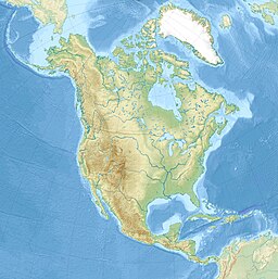
Chandalar Lake is a lake in Yukon-Koyukuk Census Area, Alaska, United States.[1] It is located roughly 183 miles (295 km) north of Fairbanks near the Brooks Range.[citation needed] It is located near, although not in, the Arctic National Wildlife Refuge.[citation needed] The lake is approximately 9.5 mi (15.3 km) in length.[1]
Climate
[edit]| Climate data for Chandalar Lake, AK, 1991–2020 normals, extremes 1940–present | |||||||||||||
|---|---|---|---|---|---|---|---|---|---|---|---|---|---|
| Month | Jan | Feb | Mar | Apr | May | Jun | Jul | Aug | Sep | Oct | Nov | Dec | Year |
| Record high °F (°C) | 38 (3) |
38 (3) |
50 (10) |
54 (12) |
83 (28) |
87 (31) |
92 (33) |
90 (32) |
78 (26) |
59 (15) |
42 (6) |
31 (−1) |
92 (33) |
| Mean maximum °F (°C) | 25 (−4) |
26 (−3) |
31 (−1) |
45 (7) |
68 (20) |
78 (26) |
80 (27) |
74 (23) |
62 (17) |
39 (4) |
26 (−3) |
23 (−5) |
81 (27) |
| Mean daily maximum °F (°C) | −3.3 (−19.6) |
−0.4 (−18.0) |
13.3 (−10.4) |
30.6 (−0.8) |
50.1 (10.1) |
64.5 (18.1) |
67.8 (19.9) |
61.0 (16.1) |
46.2 (7.9) |
23.6 (−4.7) |
4.1 (−15.5) |
−0.8 (−18.2) |
29.7 (−1.3) |
| Daily mean °F (°C) | −15.8 (−26.6) |
−12.6 (−24.8) |
−2.1 (−18.9) |
15.1 (−9.4) |
37.8 (3.2) |
52.1 (11.2) |
55.0 (12.8) |
48.5 (9.2) |
35.8 (2.1) |
14.1 (−9.9) |
−6.7 (−21.5) |
−11.0 (−23.9) |
17.5 (−8.0) |
| Mean daily minimum °F (°C) | −24.9 (−31.6) |
−24.6 (−31.4) |
−16.3 (−26.8) |
1.3 (−17.1) |
25.1 (−3.8) |
38.7 (3.7) |
41.8 (5.4) |
35.3 (1.8) |
24.6 (−4.1) |
5.6 (−14.7) |
−15.1 (−26.2) |
−22.0 (−30.0) |
5.8 (−14.6) |
| Mean minimum °F (°C) | −52 (−47) |
−51 (−46) |
−43 (−42) |
−27 (−33) |
6 (−14) |
28 (−2) |
31 (−1) |
22 (−6) |
8 (−13) |
−19 (−28) |
−38 (−39) |
−46 (−43) |
−56 (−49) |
| Record low °F (°C) | −74 (−59) |
−68 (−56) |
−62 (−52) |
−45 (−43) |
−25 (−32) |
20 (−7) |
25 (−4) |
11 (−12) |
−8 (−22) |
−44 (−42) |
−57 (−49) |
−63 (−53) |
−74 (−59) |
| Average precipitation inches (mm) | 0.45 (11) |
0.39 (9.9) |
0.42 (11) |
0.25 (6.4) |
0.58 (15) |
1.25 (32) |
1.45 (37) |
1.64 (42) |
1.27 (32) |
0.68 (17) |
0.37 (9.4) |
0.44 (11) |
9.19 (233.7) |
| Average snowfall inches (cm) | 7.1 (18) |
6.2 (16) |
4.5 (11) |
4.0 (10) |
0.8 (2.0) |
0.0 (0.0) |
0.1 (0.25) |
0.0 (0.0) |
1.5 (3.8) |
8.7 (22) |
6.7 (17) |
6.7 (17) |
46.3 (117.05) |
| Average extreme snow depth inches (cm) | 18 (46) |
23 (58) |
22 (56) |
22 (56) |
7 (18) |
0 (0) |
0 (0) |
0 (0) |
0 (0) |
4 (10) |
10 (25) |
14 (36) |
10 (25) |
| Average precipitation days (≥ 0.01 in) | 9 | 8 | 9 | 8 | 7 | 6 | 10 | 10 | 7 | 6 | 8 | 8 | 96 |
| Source: WRCC[2] | |||||||||||||
References
[edit]- ^ a b U.S. Geological Survey Geographic Names Information System: Chandalar Lake
- ^ "Chandalar Lake". WRCC. Retrieved November 4, 2023.


