Câmpia Turzii
Câmpia Turzii | |
|---|---|
Câmpia Turzii town hall Câmpia Turzii Central Park Câmpia Turzii railway station Câmpia Turzii town hall | |
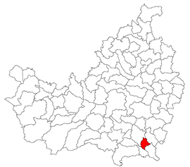
 Location in Cluj County | |
| Coordinates: 46°32′55″N 23°52′48″E / 46.54861°N 23.88000°E | |
| Country | Romania |
| County | Cluj |
| Government | |
| • Mayor (2020–2024) | Dorin Lojigan[1] (PNL) |
Area | 23.78 km2 (9.18 sq mi) |
| Elevation | 300 m (1,000 ft) |
| Population (2021-12-01)[2] | 20,590 |
| • Density | 870/km2 (2,200/sq mi) |
| Time zone | EET/EEST (UTC+2/+3) |
| Postal code | 405100 |
| Area code | +40 x64 |
| Vehicle reg. | CJ |
| Website | campiaturzii |
Câmpia Turzii (Romanian pronunciation: [kɨmˌpi.a ˈturzij]; German: Jerischmarkt; Hungarian: Aranyosgyéres) is a municipality in Cluj County, Transylvania, Romania, which was formed in 1925 by the union of two villages, Ghiriș (Aranyosgyéres) and Sâncrai (Szentkirály). It was declared a town in 1950 and a city in 1998.
The city is located in the southeastern part of the county, on the right bank of the Arieș River, at a distance of 6.7 km (4.2 mi) from Turda and 40.6 km (25.2 mi) from the county seat, Cluj-Napoca.
History
[edit]
The village of Sâncrai was mentioned in a 1219 document as "villa Sancti Regis" ("village of Holy King"),[3] while Ghiriș was first documented in 1292 as "Terra Gerusteleke" ("Gerusteleke", literally meaning "plot of Gerus" in Hungarian).
Michael the Brave was murdered by agents of Giorgio Basta at the current location of Câmpia Turzii on 9 August 1601.
Câmpia Turzii is the "city of adoption" of Toulouse[citation needed] and a sister city of Siemianowice Śląskie.
Population
[edit]| Ethnic composition of Câmpia Turzii | |||||||||||||
| Year | Romanians | Hungarians | Romani | ||||||||||
|---|---|---|---|---|---|---|---|---|---|---|---|---|---|
| 1850 | 49% | 40% | 10% | ||||||||||
| 2002 census[4] | 87.03% | 8.16% | 4.66% | ||||||||||
| 2011 census[5] | 80.93% | 6.66% | 5.06% | ||||||||||
| 2021 census | 76.42% | 4.72% | 3.32% | ||||||||||
The population has evolved as follows since 1784:
- 1784: Ghiriș: 565; Sâncrai: 472
- 1850: Ghiriș: 1,168; Sâncrai: 487
- 1910: Ghiriș: 1,815; Sâncrai: 704
- 1930 census: 4,124
- 1948 census: 6,310
- 1956 census: 11,518
- 1977 census: 22,418
- 2002 census: 26,823
- 2011 census: 22,223
- 2021 census: 20,590
Military activity
[edit]The city is home to the Romanian Air Force's RoAF 71st Air Base, and during the NATO Summit of 2008, the 323rd Air Expeditionary Wing of the United States Air Force. F-15s from RAF Lakenheath in the United Kingdom flew out during the summit to augment air defence forces for the event.
In April 2015, a U.S. Air Force group of A-10 Thunderbolt attack aircraft stationed in Germany arrived at the RoAF 71st Air Base to take part in exercises with the Romanian Air Force.[6]
Natives
[edit]- Mihai Adam, footballer
- Andra, singer
- Sebastian Cojocnean, footballer
- Andrei Cordoș, footballer
- Andrei Coroian, footballer
- Cozmin Gușă, physicist, journalist, and politician
- Iuliu Jenei, footballer
- Cosmin Mărginean, footballer
- Teodor Murășanu, writer and teacher
- Mircea Rus, footballer
- Virginia Ruzici, tennis player
- Ioan Sabău, footballer
- Cristian Silvășan, footballer
- Cosmin Văsîie, footballer
References
[edit]- ^ "Results of the 2020 local elections". Central Electoral Bureau. Retrieved 11 June 2021.
- ^ "Populaţia rezidentă după grupa de vârstă, pe județe și municipii, orașe, comune, la 1 decembrie 2021" (XLS). National Institute of Statistics.
- ^ There were two Hungarian kings canonised by this time, Stephen I of Hungary and Ladislaus I of Hungary. Ladislaus was personally involved in several battles against Cuman invaders in this region.
- ^ Centrul de Resurso. "Structura Etno-demografică a României". Retrieved 10 July 2012.
- ^ "Tab8. Populația stabilă după etnie – județe, municipii, orașe, comune". National Institute of Statistics (Romania). July 2013. Archived from the original on 2016-01-18. Retrieved 2023-10-31.
- ^ "U.S. Air Force A-10 Thunderbolt II jets have deployed to Romania". theaviationist.com. 30 March 2015.


