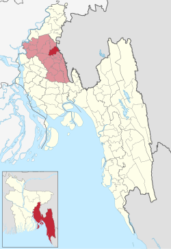
Burichang Upazila
Burichang
বুড়িচং | |
|---|---|
 Palace of Rani Mainamati | |
 | |
| Coordinates: 23°33′N 91°7.6′E / 23.550°N 91.1267°E | |
| Country | |
| Division | Chittagong |
| District | Comilla |
| Area | |
• Total | 163.76 km2 (63.23 sq mi) |
| Population | |
• Total | 349,633 |
| • Density | 2,100/km2 (5,500/sq mi) |
| Time zone | UTC+6 (BST) |
| Postal code | 3520[2] |
| Area code | 08029[3] |
| Website | Official Website of Burichong |
Burichang, also known as Burichong, (Bengali: বুড়িচং) is an upazila of Comilla District in the Division of Chittagong, Bangladesh.[4]
History
[edit]Raghunath Tarkavachaspati, a Bramhin scholar in the subject of logic migrated from Dingshai village now in West Bengal in the 17th century to establish the village of Burichang on the land granted to him by Chhatra Manikya the Maharaja of Tripura to start a Tola (an institute for Vedic learning).[5][6]
Geography
[edit]Burichang is located at 23°33′00″N 91°07′35″E / 23.5500°N 91.1264°E. It has 58,402 households and a total area of 163.76 km2 (63.23 sq mi).which is located at the extreme near the Upazila by the Dhaka Chittagong Highway. The river Gumti flows through this Upazila. There is a lot of green forests here. There are some kinds of birds and wild animals. Moreover, there are snakes and reptiles. There are mud houses here. Jackfruit, mango, blackberry, litchi, many more fruit trees can be seen. Burichang village area is within the municipality and the value of property here, like the rest of the municipality, has increased significantly.
Demographics
[edit]According to the 2011 Census of Bangladesh, Burichang Upazila had 58,402 households and a population of 301,825. 76,424 (25.32%) were under 10 years of age. Burichang had a literacy rate (age 7 and over) of 57.03%, compared to the national average of 51.8%, and a sex ratio of 1067 females per 1000 males. 12,776 (4.23%) lived in urban areas.[8][9]
Administration
[edit]Burichang Upazila is divided into eight union parishads: 4 No Sholanal Union Parishad, Bakshimul, Burichang, Moynamoti, 7 No Mokam, Pirjatrapur, Rajapur, Sholonal, and Varella. The union parishads are subdivided into 149 mauzas and 172 villages.[8]
See also
[edit]References
[edit]- ^ National Report (PDF). Population and Housing Census 2022. Vol. 1. Dhaka: Bangladesh Bureau of Statistics. November 2023. p. 396. ISBN 978-9844752016.
- ^ "Bangladesh Postal Code". Dhaka: Bangladesh Postal Department under the Department of Posts and Telecommunications of the Ministry of Posts, Telecommunications and Information Technology of the People's Republic of Bangladesh. 20 October 2024.
- ^ "Bangladesh Area Code". China: Chahaoba.com. 18 October 2024.
- ^ Rahman, Mahfuzur (2012). "Burichang Upazila". In Islam, Sirajul; Jamal, Ahmed A. (eds.). Banglapedia: National Encyclopedia of Bangladesh (Second ed.). Asiatic Society of Bangladesh.
- ^ Bengali article "Burichonger Itikatha" by Satyaranjan Bhattacharjee in "Rajat Jayanti Barsha Sankalan" published in the year 2000 by Burichong Sammelani, Kolkata
- ^ Bengali article "Burichonger Itihas" by Radhaprasanna Chakraborty in "Rajat Jayanti Barsha Sankalan" published in the year 2000 by Burichong Sammelani, Kolkata
- ^ Population and Housing Census 2022 - District Report: Cumilla (PDF). District Series. Dhaka: Bangladesh Bureau of Statistics. June 2024. ISBN 978-984-475-259-7.
- ^ a b "Bangladesh Population and Housing Census 2011 Zila Report – Comilla" (PDF). bbs.gov.bd. Bangladesh Bureau of Statistics.
- ^ "Community Tables: Comilla district" (PDF). bbs.gov.bd. 2011.

